| Date: | 1846 |
|---|---|
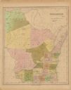
| Description: | A hand-colored map of Wisconsin shows the counties in the state south and east of the Wisconsin and Fox rivers and the locations of Indian lands to the nor... |

| Date: | 1846 |
|---|---|
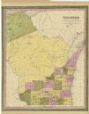
| Description: | Drawn two years before Wisconsin entered statehood, this map shows the counties and towns that existed at the time, as well as known rivers and lakes. By 1... |

| Date: | 1847 |
|---|---|
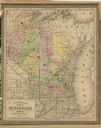
| Description: | In 1847, a year before Wisconsin entered statehood, most of the county shapes in southeastern and southern Wisconsin looked the same as they do today, wher... |

| Date: | 1852 |
|---|---|
| Description: | A hand-colored map showing portions of present-day Iron and Vilas counties north of the Manitowish River as part of the Upper Peninsula of Michigan. The Wi... |

| Date: | 1556 |
|---|---|
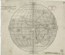
| Description: | One of the earliest obtainable maps to accurately (for its time) depict the Americas, this map shows more decorative than descriptive features. A few river... |
If you didn't find the material you searched for, our Library Reference Staff can help.
Call our reference desk at 608-264-6535 or email us at: